
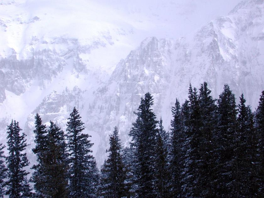
Wintry weather has returned to Colorado. Parts of the state received more than 8 inches of snow between Thursday evening and Friday morning with a “strong and colder” storm set to hit parts of the state on Friday evening into Saturday morning, continuing some places on Sunday. With expected totals in some areas at well over a foot, this is an intensification of original forecasts, which called for just four to eight inches total throughout the entire weekend.
Light snow should continue across the area through the morning and early afternoon, before decreasing this evening. Saturday starts quiet, with snow developing west to east through the day. Additional snowfall of an inch or less expected today. #cowx pic.twitter.com/wLzCNHxmxL
— NWS Boulder (@NWSBoulder)
Light to moderate snow expected across much of southern CO thru this evening. Additional light snowfall expected. Some potential for heavier bands of snow to move across the Pikes Peak region & parts of southern I-25 late this afternoon into the eve. #cowx pic.twitter.com/2IBMphKsJl
— NWS Pueblo (@NWSPueblo)
Here’s a look at the official snow totals for the past 24 hours as of Friday morning, according to the National Weather Service: Fort Garland (8.5″), Telluride (6″), Coal Bank Pass (5.5″), Wolf Creek Pass (5″), Red Mountain Pass (5″), Monarch (4″), Buena Vista (2″), Crested Butte (3″)and Snowmass Village (3.1″). To see the full list, click here.
Editor’s Note: Totals around the state may vary. Some places have been excluded from this list and many places around the state haven’t reported a total. See a full list of destinations from the National Weather Service here.
Following last nights snowfall, get ready for rounds two and three.
The National Weather Service has issued several winter weather advisories with the heavy snowfall expected in the mountains over west-central and southwest Colorado.
Map Credit: The National Weather Service.
In the northwest and southwest San Juan Mountains, Gore, Elk, and Sawatch Mountains, accumulations of 3 to 6 inches are expected on Friday and 6 to 9 inches could fall from Saturday into Sunday. Winds will also be strong, gusting up to 50 mph at times.
The first Winter Weather Advisory for this region is currently set to remain in effect until 9:00 PM, with the second in effect from 8:00 AM Saturday to 5:00 AM Sunday. Travel is expected to be very difficult during this time. Impacts are expected for the surrounding mountain towns of Telluride, Ouray, Lake City, Silverton, Rico, Hesperus, Aspen, Vail, Snowmass, Crested Butte, Taylor Park, and Marble
In the Elkhead and Park Mountains, Grand and Battlement Mesas, Flat Tops and Uncompahgre Plateau, and Dallas Divide, anywhere from 6 to 9 inches of snow could fall from 5:00 AM Saturday morning through 11:00 PM Saturday evening.
Up to 3 inches of snow is also predicted to fall through Friday evening in the Eastern San Juan Mountains, La Garita Mountains above 10,000 Feet, and Upper Rio Grande Valley.
Snow accumulations of 2 to 4 inches are likely on Friday in the Sangre de Cristo Mountains and the Raton Mesa.
Joel Gratz of OpenSnow is calling for “intense snow” dropping anywhere from 3 to 10 inches on most mountains. His forecast also points to chances of a white Christmas.
The NWS also warns of “cold wind chills as low as 15 below zero resulting in hypothermia if precautions are not taken.”
Passenger traction and trucking chain laws may be in effect. Stay alert, use slower speeds, and give yourself plenty of extra time to reach your destination. Pack your trunk with winter essentials that can help keep you safe if stranding occurs.
Editor’s Note: All weather statements and snow accumulations are subject to change. Check the official Colorado Department of Transportation website for up-to-date information on road conditions and the National Weather Service for updates on incoming storms. For your mountain forecast, we recommend visiting OpenSnow. For daily avalanche conditions, always check with avalanche.state.co.us before heading into the backcountry.
This content was originally published here.